Family walks
Our choice of stunning family walks
The Birks of Aberfeldy
Length: 3.5 km / 2.25 miles • Time: 1 – 2 hours • Start: Birks car park, Aberfeldy • Start Grid NN855486
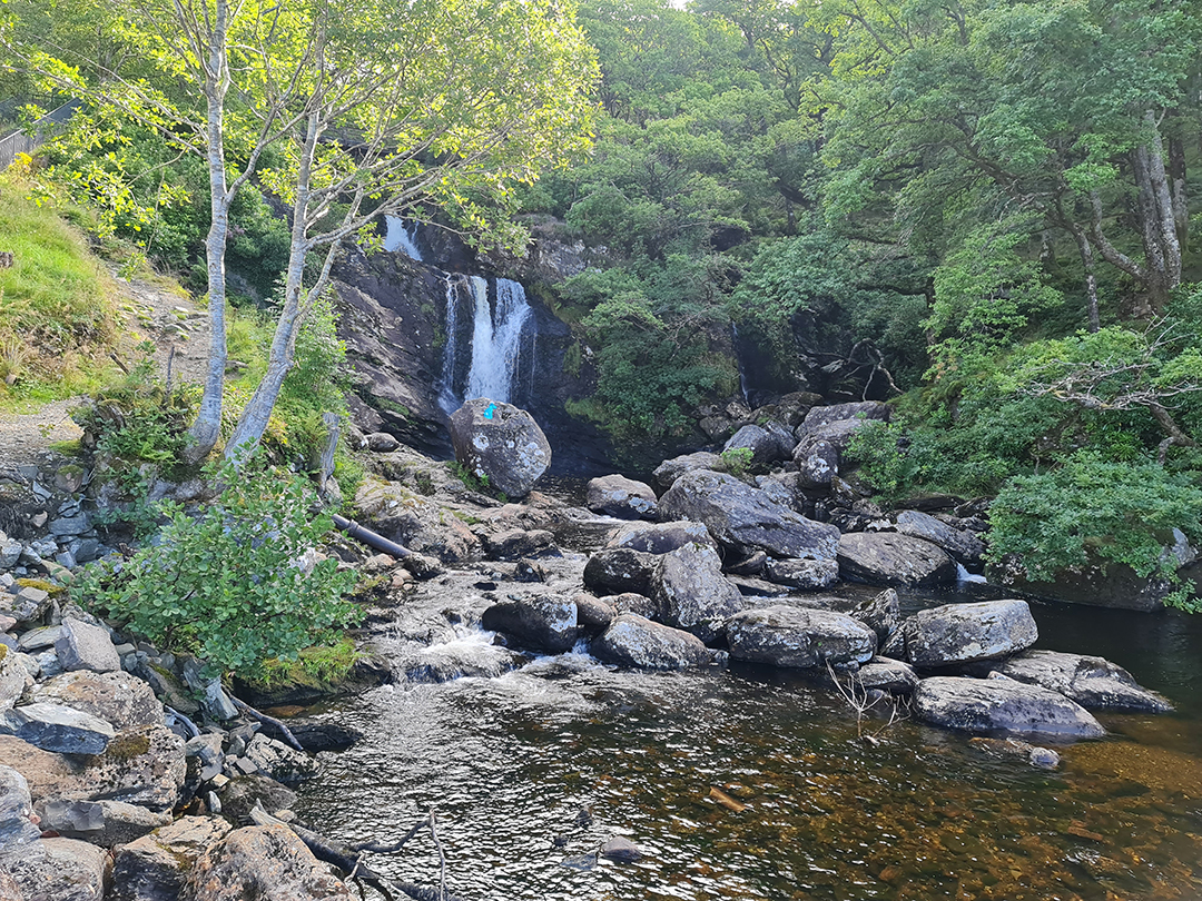
Burns’ 1787 poem The Birks o’Aberfeldie gave this circular walk its name. Covered in Birch trees, the route lines the slopes of the Moness Gorge and overlooks the falls. This beautiful short walk is extremely popular. the fine walk up the steep gorge of the Moness burn reveals several waterfalls. Excellent waymarked path; a good amount of up and downhill. The walk passes above steep drops but there are handrails for much of the route. This Perthshire path is the most striking during autumn. There are wooden walkways and stone steps which make the terrain more interesting, especially for younger children.
Loch an Eilein
Length: 7 km / 4.5 miles • Time: 2 hours • Start: Loch an Eilein car park (charge per person) • Start Grid NH896085
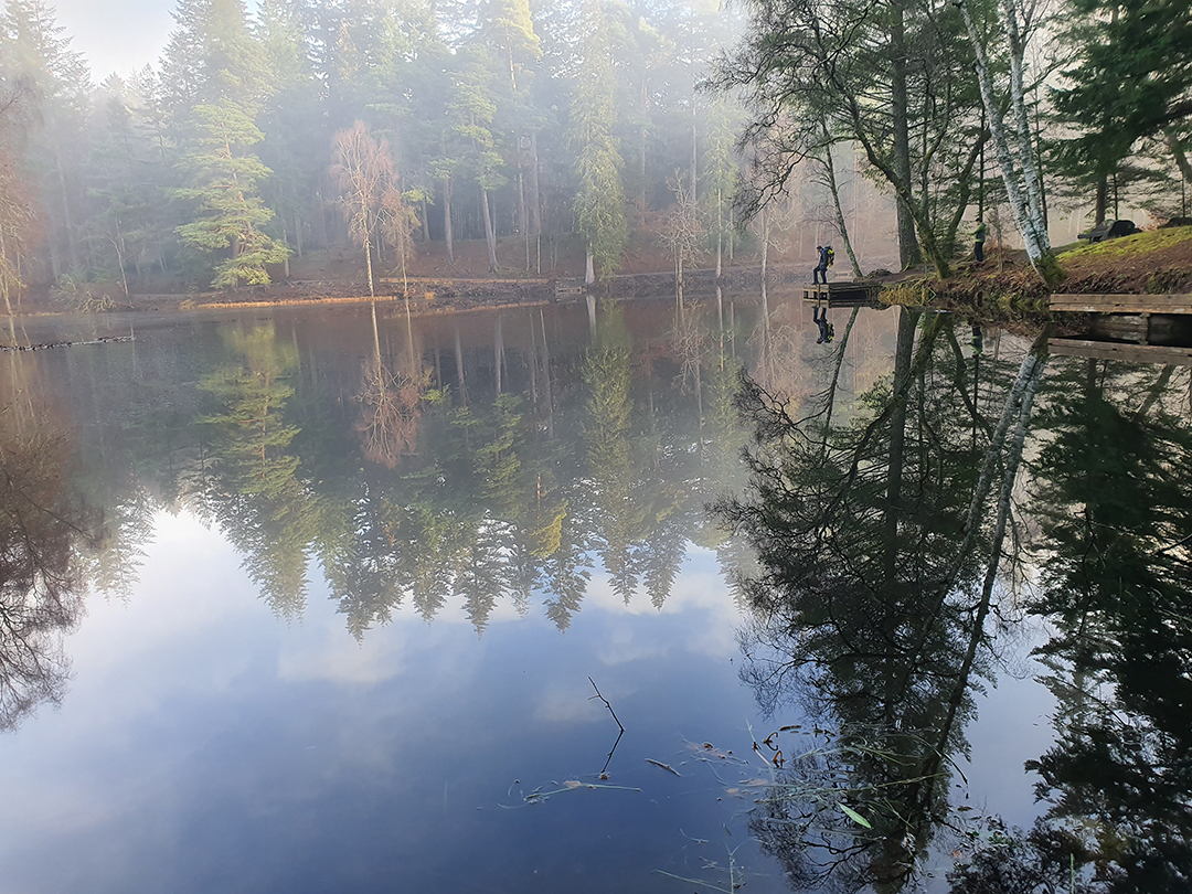
This circular route skirts round the shore of Loch an Eilein. It is an extremely beautiful sheet of water, reflecting the magnificent pines of Rothiemurchus Forest in which it lies; a ruined, 13th century island castle is the final touch to help make this one of the most popular short walks in Scotland. Good footpaths round Loch an Eilein; the optional extension around Loch Gamhna is muddy in places .The forest is renowned for its wildlife as well as its scenery, including red squirrels, roe deer and ospreys. It’s a short walk (but with possible extensions) which provides views of the surrounding mountains and it’s sheltered by ancient pine trees. So, it’s suitable even for rainy days.
Falls of Bruar
Length: 2.5 km km / 1.5 miles • Time: 1 – 1.5 hours • Start: House of Bruar car park, near Blair Atholl
With a gorge, waterfalls, and bridges, this is a fun wee walk behind the House of Bruar shopping centre. A beautiful short but surprisingly strenuous walk with good views of the gorge and falls from two stone bridges and a picnic area. Clear paths on a hilly route with some steep sections and sheer drops at the gorge edge. It’s only eight miles from Pitlochry. Robert Burns, on his visit to the beauty spot, wrote The Humble Petition of Bruar Water to the Duke of Atholl.
The Hermitage and Braan Walk, Dunkeld
Length: 6.5 km / 4 miles • Time: 2 hours • Start: Hermitage car park (just off the A9 at Dunkeld)
Queen Victoria is among the notable admirers of this woodland route in Perth and Kinross. This varied walk is a real Perthshire classic. It begins through the beautiful wooded glen of the Hermitage, complete with picturesque follies and attractive waterfalls. The route then continues to visit the dramatic Rumbling Bridge before a return through more open countryside with attractive views. The Hermitage is owned by the National Trust for Scotland. Clear waymarked paths, tracks and minor roads.
The Old Man of Storr
Length: 4.5 km / 2.75 miles • Time: 1.5 – 2 hours • Start: Storr car park, off A855 • Star Grid NG508528
Probably the most famous walk on Skye, The Storr hill boasts unusual rock formations. A straight pinnacle which stands on its own. A gigantic ancient landslide created the formations. This deservedly very popular walk climbs up for a close look at the massive pinnacle of the Old Man of Storr - one of Scotland's most iconic places. Clear hill paths, steep and rocky higher up. Signs warn of danger from rockfall. On a clear day, hikers can enjoy views over the Sound of Raasay to the mainland. Unfortunately, as there are no trees there is no shelter when the inevitable Skye rain falls! This walk is slightly challenging in places as it becomes steeper and rocky. It takes roughly an hour and a half to complete both the ascent and descent.
St. Abb’s Head
Length: 6.25 km / 4 miles • Time: 2 hours • Start: National Trust car park above St Abbs • Start Grid NT 913674
For a dramatic coastal path with views of thousands of nesting seabirds in the summer, head to St. Abb’s Head in the Scottish Borders. The area gets its name from Saint Æbbe who founded a monastery there. Volcanic lava formed the rock of the Head around 400 million years ago. It is a dramatic coastal headland, ringed by cliffs and famed for its seabird colonies. This walk takes you around the Mire Loch and up around the cliffs of the Head, a National Nature Reserve. It is a straightforward route and provides good views of the highly populated bird nesting areas and a lighthouse that has been in service since 1862. Tarmaced road and grassy paths alongside high cliffs with some short steep inclines. Some of the paths can be muddy and care is needed near the cliff edges.

Fife Coastal Path
Length: Choose from 1 to 187 km! (1 – 116 miles) • Time: To suit
This walk is as long or as short as required, as Fife Coastal Path stretches for 116 miles from the Firth of Forth to the Firth of Tay.The walk is split up into eight different sections, whether that be from Leuchars to Wormit Bay or Buckhaven to Elie. There’s some stunning scenery on the route.
1: Kincardine to North Queensferry (27km 6 - 8 hours) 2: North Queensferry to Burntisland (18.5km 4.5-5.5 hours) 3: Burntisland to East Wemyss (18.75km 4.5-5.5 hours) 4: East Wemyss to Lower Largo (11.5km 3 - 3.5 hours) 5: Lower Largo to St Monans (14km 3 - 4 hours) 6: St Monans – Anstruther (5.75km 1.5 - 2 hours) 7: Anstruther to Crail (6.75km 1.5 - 2 hours) 8: Crail to Kingsbarns (9.5km 3 - 3.5 hours) 9: Kingsbarns to St Andrews (13.5km 3 - 4 hours) 10: St Andrews - Newport on Tay (29km 6 - 8 hours) 11: Newport on Tay to Newburgh (28.5km 7 - 8 hours)
Coire Lagan
Length: 9 km / 5.75 miles • Time: 3 – 5 hours • Start: Parking at Glen Brittle, near campsite and beach • Start Grid NG 408206
This one starts at Glen Brittle beach and provides spectacular views of the intimidating Black Cuillin Mountains. Coire Lagan is one of the most impressive corries in the Cuillin, a tiny loch ringed by gigantic rock peaks - an unforgettable place to visit. The walk up to it has the benefit of a good path initially, becoming rougher with some minor scrambling higher up. Mostly on good paths; rough ground with simple scrambling near the mouth of the coire. The route is relatively easy with some minor scrambling higher up. In all, it’s a steady ascent and boasts stunning views over Loch Brittle. In the glacier-carved coire there’s a lochan which is the perfect picnic spot on a clear day. Serious climbers can progress higher beyond the coire. During the descent, there is the spectacular 40-metre waterfall Eas Mor.
THE BROUGH OF BIRSAY AND EARL'S PALACE, MAINLAND
Distance 6km/3.75miles • Time: 2-2.5hr) • Start Grid HY242283
This little island off the north-west coast of Orkney’s Mainland is just a short walk along a tidal causeway, from a small car park at Birsay. This exploration of the far north-west tip of Orkney Mainland features rugged cliffs, a tidal causeway and centuries of history. Note: access the the Bough of Birsay is only possible within two hours either side of low tide. Tide times are available online - note these are GMT and so must be adjusted during the summer. There is a charge to visit the island in the summer months. Concrete tidal causeway, grass/sand footpaths and surfaced roads.
RIVER NESS AND CALEDONIAN CANAL CIRCUIT, INVERNESS
Distance: 11.5km / 7.25 miles • Time: 3.5 - 4.5 hours • Ascent: 57m (Profile) • Start Grid: Ref NH666452
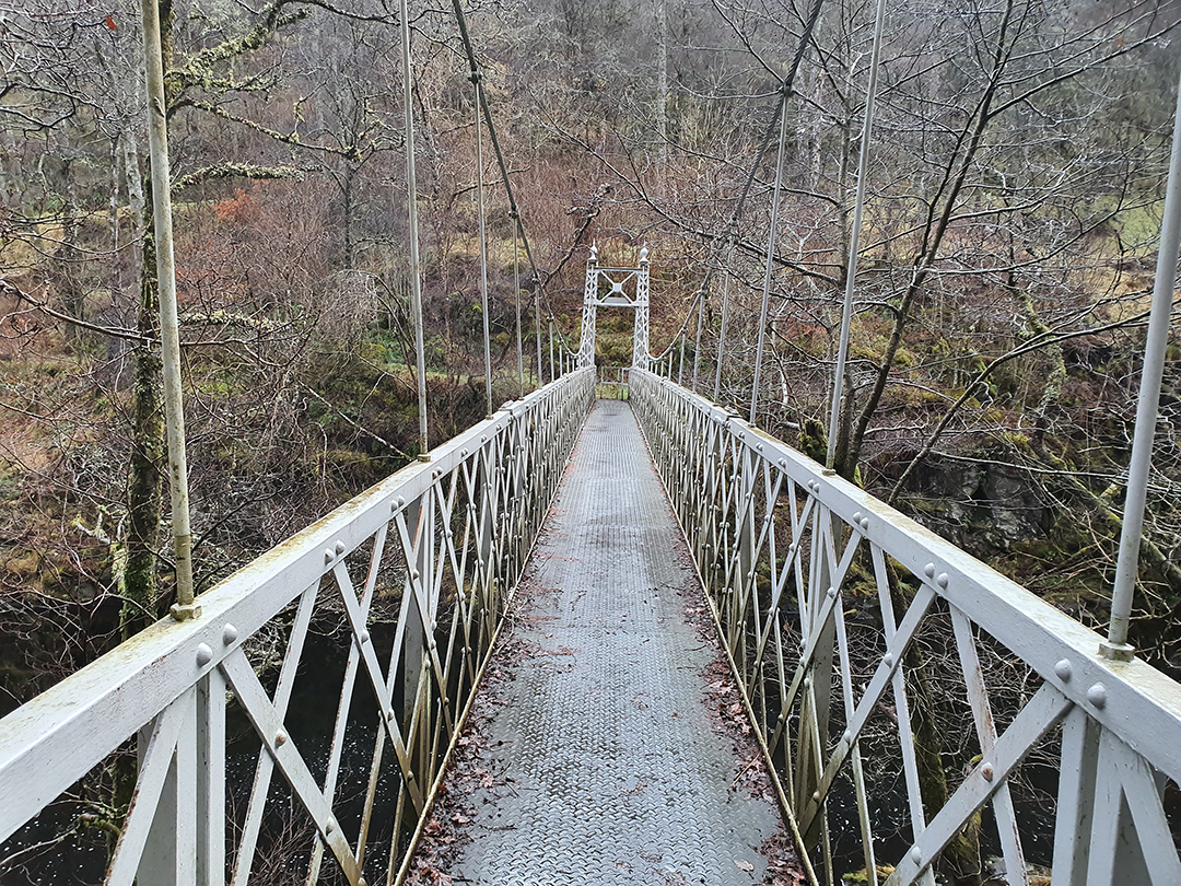
A walk around Inverness on the banks of the River Ness, the Caledonian Canal and the coast. It makes an interesting walk whilst staying in the city, or as an easier option on a rainy day. Canal towpaths, roads and riverside paths. The Ness Islands are a popular oasis of calm in the centre of Inverness. Set in the River Ness, these islands are connected to the city by suspension bridges built in the Victorian era.
HILL 99 TRAIL, CULBIN FOREST, MORAY SPEYSIDE
Distance: 6km / 3.75 miles • Time: 1.5 - 2 hours • Ascent44m (Profile) • Start Grid Ref: NH997613
Home to seals and a wide range of birdlife. A great introductory exploration of Culbin Forest, visiting a high wooden tower with views over the dunes and the Moray Firth. Children will particularly like the tower and other points of interest. Excellent, waymarked paths and tracks, suitable for all terrain baby buggies.
LOCH AN EILEIN, ROTHIEMURCHUS
Distance: 7km / 4.25 miles • Time: 2 hours • Ascent70m (Profile) • Start Grid Ref: NH896085
Rothiemurchus Forest is the magical setting for this sparkling loch near Aviemore in the Cairngorms National Park. Loch an Eilein is an extremely beautiful sheet of water, reflecting the magnificent pines of Rothiemurchus Forest in which it lies; a ruined island castle is the final touch to help make this one of the most popular short walks in Scotland. The route is described here with an optional extension around the quieter Loch Gamhna; another possible extension is to ascend Ord Ban for wonderful views. Good footpaths round Loch an Eilein; the optional extension around Loch Gamhna is muddy in places and is not maintained.
BURN O' VAT AND THE CULBLEAN CIRCUIT, ABERDEENSHIRE
Distance: 6.5km / 4 miles • Time: 1.5 - 2 hours • Ascent: 200m (Profile) • Start Grid Ref: NO429996
This circular walk takes in the impressive geological feature known as the Vat, a deep, water gouged bowl that you can enter, and then rises through pleasant pinewoods and more open countryside to make a good circuit through the Muir of Dinnet National Nature Reserve. Forest paths; the Vat is visited using stepping stones.
MONTROSE BASIN, ANGUS
Distance: 5.75km / 3.5 miles • Time: 1.5 - 2 hours • Ascent: 8m (Profile) • Start Grid Ref: NO668591
Montrose Basin on the Angus Coast is a huge enclosed estuary teeming with birdlife and wildlife. Short tracks leading down to the basin start from Bridge of Dun and Mains of Dun, where you can really appreciate the scale of the basin. It is a large tidal basin of mud, sand, salt marsh and reed bed. It is an important local Nature Reserve and a great place to visit for birdwatchers. This walk visits parts of the western fringe of the basin, including two hides. Clear tracks, often wet paths, level.
TENTSMUIR POINT - FOREST AND DUNES, NEAR LEUCHARS
Distance: 5.5km / 3.5 miles • Time: 1.5 - 2 hours • Ascent: 5m (Profile) • Start Grid Ref: NO498242
Discover a massive sand dune system, one of Scotland’s most dynamic coastlines, a pine-scented forest and wonderful wildlife - including seals - at Tentsmuir National Nature Reserve and explore the dunes of Tentsmuir Point nature reserve, a great place to watch waders and wildfowl. The return is via a 19th century ice-house and through forest inhabited by red squirrels. It’s an ideal place for walking and off-road cycling and a picnic on the beach. Collect seashells and look out for red squirrels and dragonflies too. Woodland paths, dunes, level forestry track.
LADY MARY’S WALK, CRIEFF
Stunning woodland walk named after Lady Mary Murray, whose family were local landowners in the early 19th century, Lady Mary’s Walk goes through beautiful woodland and along the banks of the River Earn and is great for bikes and buggies. Some of the trees here are over 150 years old and stunning in all seasons. Herons, kingfishers, grey wagtails, oystercatchers and dippers all live on the river and otters have been seen at dusk. A longer walk taking in Lady Mary’s Walk and Laggan Hill is another option and Crieff offers many family-friendly eateries and play areas.
GRUFFALO TRAIL, ARDKINGLAS, ARGYLL
Ardkinglas House is an impressive and historic exclusive-use venue on the shores of beautiful Loch Fyne in Argyll. The Woodland Garden here, part of the 12,000-acre estate, is open year-round and contains an impressive collection of trees, including one of Britain’s tallest. The highlight for kids is, undoubtedly, the Gruffalo Trail. Pick up the trail map from the mouse, who will guide you along the route to find the Gruffalo. There’s an admission charge for the trail and there’s also the Treeshop garden centre, gift shop and café if you’re looking for a spot of lunch and souvenirs. The woodland provides the ideal place for a peaceful woodland walk and family day out and can be enjoyed throughout the year. During spring and early summer the woodland bursts with colour thanks to the bluebell carpet and extensive collection of rhododendrons and azaleas.
LOCH ARD SCULPTURE TRAIL, BY ABERFOYLE
Distance: 6.75km / 4.25 miles • Time: 1.5 - 2.5 hours • Ascent: 160m (Profile) • Start Grid Ref: NN498010
Loch Ard in Loch Lomond & The Trossachs National Park is home to the Loch Ard Sculpture Trail, a fine family walk, where the kids will have fun discovering the sculptures. This fine forestry circuit follows a track up to the attractive Ghleannain Loch before descending to reach Loch Ard. The return walk beside the latter loch is pure delight. Forest tracks and paths with some steep sections.
SCOTTISH BEAVER TRAIL, KNAPDALE FOREST
In deepest Argyll Knapdale Forest, an area which is rich in history and wildlife. It’s here, near Lochgilphead, that beavers were officially re-introduced into Scotland. For a great family-friendly walk, follow the Scottish Beaver Trail, where the kids can become beaver detectives by looking out for tell-tale signs of their activity. Begin the trip at the Barnluasgan Information Centre, where you will learn about beavers and their return to Scotland. Then follow the 3 mile (5 km) circular trail and keep your eyes peeled for teeth marks on trees, beaver canals and ripples in the water. Beavers are shy though, so remember to go quietly.
ARTHUR'S SEAT AND HOLYROOD PARK, EDINBURGH
Distance: 4.75km / 3 miles • Time2 - 2.5 hours • Ascent279m (Profile) • Start Grid Ref: NT270737
Would you like a proper hill walk in the heart of the city if yes answer is Arthur's Seat's rocky summit towers over Edinburgh, with fabulous views in all directions? It is an ancient volcano in the city, so kids will love it! Only a short walk from Edinburgh’s Royal Mile and family attractions such as Dynamic Earth and the Museum of Childhood, Arthur’s Seat dominates Holyrood Park. Some rough ground if the top of Salisbury Crags is crossed as described; ascent of Arthur's Seat is very steep and rocky.
SMUGGLERS’ TRAIL! BERWICKSHIRE COAST EYEMOUTH TO BERWICK
Distance: 19km / 11.75 miles • Time: 5 - 6 hours • Ascent320m (Profile) • Start Grid Ref: NT943644
This Coastal Path runs from the fishing port of Eyemouth to Berwick. Once a haven for smugglers, Eyemouth is now mainly a fishing port and a base for tourists. The port is a home to a fleet of about 20 fishing boats and in the summer this number can double. The route takes you along the cliff tops, on across the Border to Berwick upon Tweed, just across the Border in England. Trail takes you on a journey to see some out-of-the-way coves and beaches that the ‘free traders’ used in days of old. There are also shorter options, such as a climb to Blaikie Heugh. Mainly cliff top paths and some tarmaced roads and pavements.
FALLS OF CLYDE AND NEW LANARK, LANARKSHIRE
Distance: 6km / 3.75 miles • Time: 1.5 - 2 hours • Ascent230m (Profile) • Start Grid Ref: NS882425
Only 45 mins drive from Glasgow this short walk along the Clyde, surrounded by lush woodlands, from the World Heritage Site of New Lanark is a bona fide Scottish classic. Passing a powerful series of waterfalls as it passes up a beautiful wooded gorge before a more placid return route takes you through fields and woodland. The walk can be extended by following a waymarked additional route on the far side of the river. Clear path with many steps and lots of short up and down sections. Care should be taken with children on boardwalk section next to river or above cliffs. Suggested return route is muddy but you could return via the outward route.
KELBURN CASTLE & COUNTRY PARK, BY LARGS
13th century castle, Kelburn Estate, near Largs in Ayrshire & Arran, is a great place for a family day out, with the flamboyant designs on the castle walls sure to captivate curious young minds. The Kelburn Glen, with its waterfalls and deep gorges, is regarded by many as one of Scotland’s most beautiful and the Short Glen Walk/Sculpture Trail is a great option for families. Kids will also love the Secret Forest - a network of enchanting woodland paths with amazing surprises along the way. After all that, there’s still the Adventure Course, Pets Corner and the Playbarn to explore!
Conic Hill, Balmaha
Distance: 4km / 2.5 miles • Time2 - 3 hours • Ascent350m (Profile) • Start Grid Ref: NS421909
Conic Hill is a sharp little summit rising above Balmaha. Right on the Highland Boundary Fault, this short hillwalk offers truly fantastic views over Loch Lomond and its many islands. Good path on the ascent, with steps. The detour from the West Highland Way up to the summit involves a short rocky scramble. There is another circular route little longer around 9km as an optional.