Top 20 Favourite walks in Scotland
20: Ben More, Isle of Mull

Distance: 9.25km / 5.75 miles - Time: (summer conditions) 5 - 6.5 hours - Ascent: 945m - Start Grid Ref: NM494359
A straightforward route up and down Ben More, this is Mull's only Munro, and makes for a great hillwalk avoiding the need for any scrambling. Rough path, boggy in places lower down and stony higher up.
19: Lochnagar Circuit, Glen Muick

Distance: 19km / 11.75 miles - Time: (summer conditions) 6 - 7 hours - Ascent: 930m (Profile) - Start Grid Ref: NO309851
One of the most popular and much the finest mountain of the Mounth - or perhaps even of the Cairngorms as a whole. It was immortalised in verse by Lord Byron. Route follows clear tracks and mountain paths; the boulder section has a good path.
18: Five Sisters of Kintail, Kintail

Distance: 15km / 9.25 miles - Time: (summer conditions) 8 - 10 hours - Ascent: 1385m (Profile) - Start Grid Ref: NH009135
A superb ridgewalk taking in three Munros, Sgùrr na Ciste Duibhe, Sgùrr na Càrnach and Sgùrr Fhuaran give a wonderful days excursion with magnificent views. Path is very steep on ascent; there is a little scrambling along the ridge itself and much rocky ground.
17: Slioch (The Spear), Wester Ross

Distance: 19km / 11.75 miles - Time: (summer conditions)8 - 9 hours - Ascent: 1144m (Profile) - Start Grid Ref: NH038624
Slioch is a mountain in the Scottish Highlands situated in Wester Ross, eight kilometres north of the village of Kinlochewe. Slioch is one of the best known and most photographed sights in the Highlands. The view of the craggy fortress of Slioch across the waters of Loch Maree is one of the classics of Scotland featured in countless calendars. It is a long, tough walk with some steep, rough terrain and boggy ground; pathless section on return.
16: Bidean nam Bian

Distance: 11km / 6.75 miles - Time: (summer conditions) 7 - 9 hours - Ascent: 1316m (Profile) - Start Grid Ref: NN170569
Walk includes 2 munros Bidean nam Bian and Stob Coire Sgreamhach. The highest mountain in the old county of Argyll, Bidean nam Bian is the whole majestic range of mountains on the south side of Glen Coe. It's dramatic northern ridges are famously known as the Three Sisters. Terrain is steep, rocky and complex terrain. The terrain is very rocky and there are sections of steep scree and very mild scrambling. The descent from Bealach Dearg is initially very steep and loose.
15: Schallion

Distance: 10km / 6.25 miles - Time: (summer conditions) 4 - 6 hours - Ascent: 731m (Profile) - Start Grid Ref: NN753556
Schiehallion is a prominent cone-shaped mountain in the Breadalbane region of the Scottish Highlands, in the county of Perthshire. It rises to 1,083 metres and is classed as a Munro. Excellent path most of the way; final section to summit across boulders.
14: Blaven, Isle of Skye

Distance: 8km / 5 miles - Time: (summer conditions) 5 - 6 hours - Ascent: 990m (Profile) - Start Grid Ref: NG560215
Also known as Blà Bheinn or Blàbheinn, is a mountain on the Isle of Skye in Scotland. It is usually regarded as an outlier of the Black Cuillin range.
13: Liathach, Glen Torridon
Distance: 11.5km / 7.25 miles - Time: (summer conditions) 8 - 10 hours - Ascent: 1326m (Profile) - Start Grid Ref: NG935566
Liathach is a mountain in the Torridon Hills, in the Northwest Highlands of Scotland. It stands between Loch Torridon and the neighbouring mountain Beinn Eighe. The mountain is a ridge running east–west, with several peaks, and its upper half is made up of many steep rocky terraces. It consist a well-trodden but very steep terrain throughout. There is mild rock scrambling en-route to the ridge, and some awkward bouldery terrain along it. The Am Fasarinen pinnacles involve some trickier scrambling, and the alternative bypass path is very exposed. The descent from Mullach an Rathain is also very steep. If unsure, hire a guide.
12: Ben Nevis on the Carn Mor Dearg Arête, Lochaber
Distance: 17.5km / 11 miles - Time: (summer conditions) 10 - 11 hours - Ascent: 1506m (Profile) - Start Grid Ref: NN144763
Good mountain paths for much of the route; pathless section on descent with burn crossing. The traverse of the arête is a long but easy scramble. For experienced, fit mountain walkers who do not mind easy scrambling but are not climbers, this is the finest way to climb Ben Nevis. This is a truly spectacular route incorporating two Munros.
11: Stac Pollaidh, Northwest Highlands
Distance: 4.5km / 2.75 miles - Time: (summer conditions) 2 - 4 hours - Ascent: 510m (Profile) - Start Grid Ref: NC107095
An excellent pitched path makes the going good underfoot; the return path around the west side is boggier and more eroded. The climb up to the ridge is steep. The route described does not reach the true, western summit of the mountain which requires a high level of scrambling expertise.
10: Ben Lomond, Loch Lomond
Distance: 12km / 7.5 miles - Time: (summer conditions) 4.5 - 5.5 hours - Ascent: 990m (Profile) - Start Grid Ref: NS359986
Clear path with some rocky sections, most especially on the alternative, rougher return route. As with all mountain walks, full hillwalking clothing and equipment must be carried. Ben Lomond is one of the most popular Munros. The view to the north reveals range beyond range of mountains into the Highlands. The path up is well made, but the optional return down the Ptarmigan ridge is steep and rocky, and muddy lower down.
9: White Coomb by the Grey Mare's Tail
Distance: 11.5km / 7.25 miles - Time: (summer conditions) 4 - 6 hours - Ascent: 751m (Profile) - Start Grid Ref: NT186144
White Coomb is the highest of the Moffat hills. This circular hillwak is the classic approach, heading up past the spectacular Grey Mare's Tail to beautiful Loch Skeen. It then encounters some tough going before reaching the tops at Lochcraig Head. From here broad ridges are followed around to the summit of White Coomb. Pitched stone footpath to Loch Skeen, but heavy going across boggy moorland beyond. From Lochcraig Head the route has easier going along broad, boggy ridges before a final steeper descent. There is a burn crossing which may give difficulty after heavy rains.
8: Old Man of Hoy, Orkney
Distance: 9.25km / 5.75 miles - Time: 2.5 - 3 hours (return) - Ascent: 220m (Profile) - Start Grid Ref: ND201992
This is the essential, classic walk on Hoy, following the clear coastal path uphill from Rackwick to view the spectacular sea stack, the Old Man of Hoy, before returning by the same route.
7: Lost Valley (Coire Gabhail), Glen Coe
Distance: 4km / 2.5 miles - Time: (summer conditions) 2 - 3 hours - Ascent: 335m (Profile) - Start Grid Ref: NN170569
Steep and rocky path with some mild scrambling; great care needed. Coire Gabhail is the hidden valley where the MacDonalds of Glen Coe hid their rustled cattle. A visit involves a very rough but intensely dramatic and scenic walk.
Coire Gabhail is the hidden valley where the MacDonalds of Glen Coe hid their rustled cattle. A visit involves a very rough but intensely dramatic and scenic walk.
6: Pap of Glencoe
Distance7km / 4.25 miles - Time (summer conditions): 3.5 - 5 hours - Ascent: 716m (Profile) - Start Grid Ref: NN107587
Steep and boggy climb on a very eroded and rough path to the ridge; the final ascent of the Pap is rocky and almost a scramble. Sgòrr na Cìche, the Pap of Glencoe is a familiar landmark around the lower end of the glen and Loch Leven. Despite its modest height, it is a sensational viewpoint and gives a short but steep and very rough hill walk.
5: Goat Fell
Distance: 10.5km / 6.5 miles - Time: (summer conditions) 4.5 - 6 hours - Ascent: 874m (Profile) - Start Grid Ref: NS012376
Goat Fell is the highest point on the Isle of Arran and the culminating point of some dramatic granite ridges. At 874 metres, it is one of four Corbetts on the island. The mountain, along with nearby Brodick Castle, is now owned by the National Trust for Scotland. This fine pyramidal peak and a magnificent viewpoint is the most popular and straightforward route of ascent. Good footpaths for most of the route; the final section weaves steeply up through granite boulders to the summit.
4: Beinn Each
Distance: 7km / 4.25 miles - Time (summer conditions) 3.5 - 4.5 hours - Ascent: 693m (Profile) - Start Grid Ref: NN 582 137 ....... if you add Stùc a' Chròin: Distance: 12.7km / 7.9 miles - Time (summer conditions) 6 - 7 hours - Ascent: 1124m -Start Grid Ref: NN 582 137
Beinn Each is a mountain and popular Corbett rises steeply in the southern Grampian Mountains of Scotland. It is located in Stirlingshire, north of the town of Callander. Rising steeply from the valley below, it makes for a straightforward climb from the nearby Loch Lubnaig and is often climbed in conjunction with the nearby Munro Stùc a' Chroin. The ascent is via a steep hill path and can be accomplished quickly; the walk can be extended by a much rougher and trickier continuation to Stùc a' Chròin. Hill path to Beinn Each - steep in places.
3: Ben Vrackie
Distance: 10km / 6.25 miles - Time: (summer conditions)3.5 - 4 hours - Ascent: 787m (Profile) - Start Grid Ref: NN943595
Well-made path with some steep sections on the ascent of Ben Vrackie. Ben Vrackie is indelibly associated with the town of Pitlochry at its foot, and has for long been an extremely popular ascent for those visiting the town and is situated in Perthshire, Scotland. The summit may be reached easily by a direct path from Pitlochry or Killiecrankie, and commands views of Pitlochry and the surrounding glens The summit is a great viewpoint and the ascent follows good paths through woodland, open moorland and past picturesque Loch a' Choire.
2: Cobbler, Arrochar Alps
Distance: 11km / 6.75 miles - Time: (summer conditions) 4 - 6 - hours - Ascent 920m (Profile) - Start Grid Ref: NN294048
The Cobbler is an 884 metres mountain located near the head of Loch Long in Argyll and Bute, Scotland. It is a Corbett, and is an important site for rock climbing in the Southern Highlands. Many maps include the name Ben Arthur, but the name The Cobbler is more widely used. Clear paths with some steep rocky sections, particularly on the descent. The Cobbler - also known as Ben Arthur - has the most distinctive outline of any mountain in the Southern Highlands and makes a fantastic shorter hill walk. Extremely popular, the path on the way up has been improved in recent years and once past the initial zig zags makes a pleasant ascent. This route explores both main peaks of the Cobbler before descending on a rugged path between the two. Alternatively the route can be made easier by returning the same way. There is a large car park off the A83 at Succoth just to the west of Arrochar. The walk is vaguely waymarked in red; it begins on the opposite side of the road to the car park.
1: Ben A'an
Distance: 3.7km / 2.25 miles - Time: 2 - 4 hours - Ascent 340m (Profile) - Start Grid Ref: NN509070
Ben A'an is a mountain in the Trossachs in Scotland. The pointed peak of its west top resembles a small mountain. The excellent path has recently been rebuilt but the route is still steep. Ben A'an is one of the most popular amongst Scotland's smaller hills. Often known as the mountain in miniature, its position at the heart of the Trossachs makes it a truly wonderful viewpoint. The car park quickly becomes full on sunny weekends in summer, nearest alternative Ben Venue carpark 450m along A821 towards Aberfoyle.
All time super favourite Long distance best walk
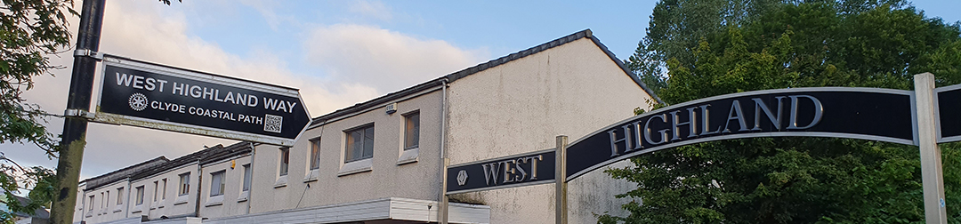
The West Highland Way
The West Highland Way is a linear long-distance route in Scotland. It is 154 km long, running from Milngavie north of Glasgow to Fort William in the Scottish Highlands, with an element of hill walking in the route. Well-waymarked throughout and avoiding the high tops, the route is within the capabilities of most walkers. It still has enough challenge and ascents to inspire the imagination; one of the toughest parts unexpectedly is the walk up the east side of Loch Lomond, whilst other sections are very exposed.
you can break this walk into 3 to 8 sections as you wish and at your pace you wish to choose.
1: Milngavie to Drymen 19km 5 - 6 hours
2: Drymen to Rowardennan 23km 6 - 7 hours
3: Rowardennan to Inverarnan 22km 6 - 7 hours
4: Inverarnan to Tyndrum 19km 5 - 6 hours
5: Tyndrum to Inveroran 14km 4 - 5 hours
6: Inveroran to Kings House 15.5km 4 - 5 hours
7: Kings House to Kinlochleven 14km 4 - 5 hours
8: Kinlochleven to Fort William 24.5km 6 - 7 hours